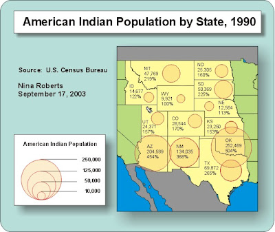
A continuously variable proportional circle map is, apparently, a map which uses circles to create "point data." The photo on the left is a map, with info dated September 17, 2003, was compiles to show Native American populations by certain states. Its URL is: http://vin25maps.blogspot.com/2009/04/continuously-variable-proportional.html
No comments:
Post a Comment